


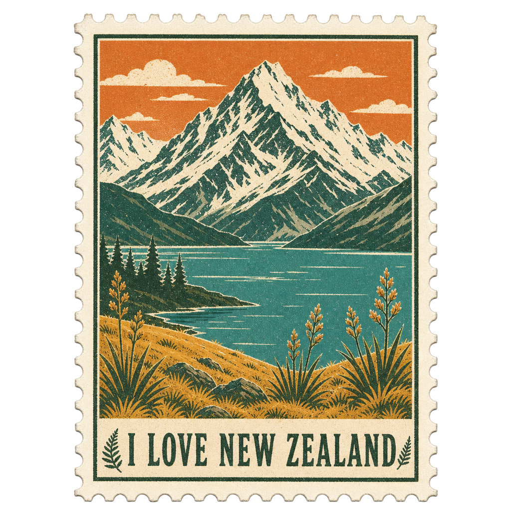
The Southern Alps rising behind a still alpine lake

The I Love New Zealand Travel Magazine

2026–2027 Edition

An illustrated companion to travelling Aotearoa — 2026–2027 edition

Facts last checked 21 August 2026 · original editorial and illustration

Contents

In this edition

  1. Welcome to AotearoaI
  2. Before You GoII
  3. When to VisitIII
  4. Getting AroundIV
  5. North Island destinations13
  6. South Island destinations15
  7. Itineraries & toursPlan
  8. The Little Black BookDirectory

Chapter I

Welcome to Aotearoa

Two long islands in the South Pacific, roughly the length of Great Britain and holding about five million people. Understand the shape of the place and the rest of the trip plans itself.

New Zealand rewards travellers who slow down. The distances on a map look modest — the country is around 1,600 kilometres from the far north to the deep south — but almost nothing here is a straight line. Roads bend around harbours, climb over saddles and hug coastlines that never quite finish. The single most useful habit you can bring is to halve the number of places you planned to visit and double the time you give each one.

The North Island is volcanic and warm-tempered: geothermal country in the middle, surf coasts on both flanks, vineyards in the east, and two cities — Auckland and Wellington — that could not be less alike. The South Island is the alpine one, built along the spine of the Southern Alps, with glaciers and fiords on the wet western side and dry golden basins in the east. A three-hour ferry between Wellington and Picton stitches them together, and that crossing is one of the finest pieces of public transport on earth.

This is also Aotearoa, and Māori culture is not a museum exhibit here — it is present in place names, in greetings, in the protocols of a marae visit and in the way many New Zealanders speak. Learning a handful of words and pronouncing place names with care will change the quality of your welcome. Macrons matter: the line over a vowel lengthens it, so Taupō, Wānaka and Whanganui are said fully, not clipped.

The other thing to know is that the natural world here is genuinely wild and genuinely fragile. Weather can turn inside an hour in the mountains, rivers rise fast, and the coast is unpatrolled almost everywhere outside the main beaches. At the same time, the ecosystems are so unusual — a country of birds, with almost no native land mammals — that the smallest acts of care, cleaning your boots between forests, staying on the track, keeping your distance from wildlife, make a measurable difference.

Halve the places. Double the time. New Zealand will do the rest.

Good to know

Orientation in one minute

  • Two main islands, connected by the Wellington–Picton ferry (about 3½ hours).
  • Driving is on the LEFT. Distances are in kilometres, speed limits in km/h.
  • Currency is the New Zealand dollar (NZD). Card payment is accepted almost everywhere; carry a little cash for rural honesty boxes and small markets.
  • The country sits on the boundary of two tectonic plates — earthquakes and geothermal activity are part of daily life, and well managed.
  • Tap water is safe to drink in towns and cities. In the backcountry, treat water from streams.

ILNZ tip

Say it properly

  • Vowels are pure and consistent: a as in 'car', e as in 'egg', i as in 'ski', o as in 'or', u as in 'zoo'.
  • 'Wh' is usually said close to an English 'f' — so Whakatāne begins fa-, and Whanganui begins fa-.
  • 'Ng' is one sound, as in 'singer' — Ngāuruhoe, Tongariro.
  • Kia ora is hello and thank you at once. Ngā mihi closes a message warmly.

Chapter II

Before You Go

The short, unglamorous list that protects the trip: entry, insurance, connectivity, biosecurity and the things New Zealand does differently.

Most visitors need either a visa or an NZeTA — the New Zealand Electronic Travel Authority — requested before departure, and most also pay the International Visitor Conservation and Tourism Levy at the same time. Requirements and amounts change, so treat this page as a prompt rather than an authority: confirm your own case with Immigration New Zealand before you book flights, and apply well ahead rather than at the airport.

Biosecurity is the rule New Zealanders take most seriously, and arriving travellers are often surprised by it. This is an island nation whose agriculture and native species have no defence against imported pests, so every arrival completes a declaration. Declare all food, plant material, wooden items, and any outdoor or camping equipment — especially hiking boots, tents and fishing gear. Clean soil off your boots before you pack them. Declaring something costs you a moment; failing to declare it can cost an instant fine.

Travel insurance is not a formality here. New Zealand's public system will treat you in an emergency and the country's no-fault accident scheme covers a surprising amount of injury treatment, but it will not fly you home, replace a cancelled tour or cover a rental vehicle excess. If your trip includes skiing, diving, mountain biking, alpine walking or any of the adventure activities this country is built around, read the exclusions in your policy properly before you leave.

For connectivity, an eSIM or a local prepaid SIM bought on arrival both work well, and coverage in towns and along main highways is good. It is not universal. Expect to lose signal through the central North Island, on parts of the West Coast, across the Mackenzie Basin, on the road to Milford Sound and in most of Fiordland. That is exactly why this magazine exists as a download: put the PDF on your phone before you leave the city.

Checklist

Pack for four seasons in one day

  • A genuinely waterproof jacket — not showerproof. It will earn its place.
  • Layers: merino or synthetic base, a warm mid-layer, and something windproof.
  • Broken-in walking shoes, plus sandals or jandals for beaches and campgrounds.
  • High-factor sunscreen and sunglasses. The ozone layer is thin over New Zealand and the UV index in the warmer months is fierce even under cloud.
  • Insect repellent for sandflies on the West Coast and in Fiordland. They are the one genuine nuisance in a country with no dangerous animals.
  • A reusable water bottle, a power adapter (Type I, 230V), and a paper or offline map for the gaps in coverage.

Note

Check before you travel

  • Entry rules, the NZeTA and the visitor levy: Immigration New Zealand.
  • What you must declare on arrival: New Zealand Customs Service and Biosecurity New Zealand.
  • Anything with a price, an opening hour or a schedule in this edition should be reconfirmed with the operator — we publish what was accurate when the edition was checked, not a live feed.

Chapter III

When to Visit

The seasons are inverted from the northern hemisphere and the weather is maritime, which is to say opinionated. Here is how each season actually feels on the ground.

Spring, from September to November, is the season this edition is published into, and it is quietly one of the best times to travel. The country turns violently green, waterfalls run at full volume on snowmelt, lambs appear in every paddock and the main sights are busy without being crowded. It is also the least predictable season: a warm morning in Christchurch can become a southerly with snow on the hills by evening. Travel spring with a jacket in the car and flexible plans and it will reward you with light and space that summer cannot.

Summer, December to February, is the high season for good reason — long evenings, warm sea, and the Great Walks and coastal campgrounds at their best. It is also when New Zealanders themselves take holidays, so book accommodation, ferries and popular tracks months ahead, particularly between Christmas and mid-January. Autumn, March to May, is the connoisseur's choice: settled weather well into April, vintage under way in the wine regions, and Central Otago turning gold around Arrowtown and Wānaka.

Winter, June to August, splits the country in two. The South Island becomes a ski destination, with Queenstown and Wānaka busy and beautiful, the Mackenzie skies at their clearest for stargazing, and mountain passes occasionally closed or requiring chains. The North Island is mild and damp rather than cold, which makes it the right season for geothermal Rotorua, city culture in Wellington and Auckland, and the sort of empty beach walks you cannot get in January.

The practical rule for any season: the west is wetter than the east, the south is cooler than the north, and altitude changes everything. Fiordland receives extraordinary rainfall — that is precisely why it looks the way it does, and a wet day in Milford Sound with a hundred temporary waterfalls is arguably better than a clear one.

A wet day in Milford is not a ruined day. It is the day the mountains start running.

Month by month, in broad strokes

September
Spring begins. Snowmelt, blossom, ski fields still open in the south. Quiet on the roads.
October
Green and bright, waterfalls at peak flow. Alpine tracks may still hold snow — check DOC conditions.
November
Warm days arrive, lupins colour the Mackenzie, gardens and coastal walks at their best.
December
High summer starts. Book ahead. Long evenings, pōhutukawa in flower along northern coasts.
January
Busiest and warmest. Beaches, Great Walks, festivals — reserve everything early.
February
Often the most settled weather of the year. Excellent for the far south and Fiordland.
March
Vintage in the wine regions. Sea still warm, crowds thinning. Superb for road trips.
April
Autumn colour peaks in Central Otago. Cool mornings, golden afternoons, low prices.
May
Quiet and atmospheric. First snows dust the Alps. Some alpine roads and tracks begin to close.
June
Ski season opens. Clear cold nights make the Mackenzie Dark Sky Reserve extraordinary.
July
Deep winter in the south, mild and wet in the north. Chains may be required on passes.
August
Snow at its most reliable. Whale watching off Kaikōura and geothermal Rotorua shine in the cold.

Note

Weather is the one thing we will not guess

  • Forecasts, warnings and marine conditions: MetService is the official national forecaster.
  • Long-range climate context: NIWA.
  • Alpine and track-specific conditions: Department of Conservation, plus the local visitor centre on the morning you walk.

Chapter IV

Getting Around

Driving is how New Zealand is designed to be seen. Understand the roads, the ferry and the short internal flights, and the country opens up.

Drive on the left. Give way as signed, and be aware that many rural bridges are single-lane, with a larger arrow indicating who has priority. Speed limits are 100 km/h on the open road and 50 km/h in towns unless posted otherwise, but the honest number on a winding coastal or alpine highway is well below the limit. Seatbelts are compulsory for everyone. Roadside coffee is excellent and stopping for it is part of the culture.

The single most common mistake visitors make is underestimating driving time. New Zealand's highways are mostly two-lane, they climb and turn constantly, and there are few motorways outside the main cities. A 300-kilometre day that would take three hours elsewhere takes four and a half here, and five once you stop for the views you came for. Plan on around 250 to 350 kilometres as a comfortable day, and never plan to arrive somewhere unfamiliar after dark on a gravel road.

Between the islands, the Wellington–Picton ferry crossing takes roughly three and a half hours and threads the Marlborough Sounds at the southern end — stay on deck for that hour. Two operators run the route; both carry vehicles and both fill up in summer and around public holidays, so book vehicle space early. If you are travelling with a rental car, check your provider's policy: many require you to swap vehicles either side rather than take the car across.

Domestic flying is quick and often cheap enough to buy you days back. The useful hops are Auckland–Queenstown, Auckland–Christchurch, Wellington–Christchurch and the short flights into Nelson, Napier, Dunedin, Invercargill and Rotorua. Note that the small regional aircraft carry strict baggage limits. Intercity coaches connect most towns, and two scenic rail journeys — the coastal run north of Christchurch and the alpine crossing to Greymouth — are experiences in their own right rather than mere transport.

Plan 300 kilometres a day, not 500. The country is not far; it is slow, and that is the point.

Realistic driving times — allow more with stops

Auckland → Rotorua
≈ 235 km · 3 hours
Auckland → Paihia, Bay of Islands
≈ 230 km · 3 hours
Rotorua → Taupō
≈ 80 km · 1 hour
Taupō → Wellington
≈ 375 km · 4¾ hours
Napier → Wellington
≈ 320 km · 4¼ hours
Wellington → Picton
Ferry · ≈ 3½ hours sailing
Picton → Nelson
≈ 110 km · 1¾ hours
Picton → Kaikōura
≈ 155 km · 2¼ hours
Kaikōura → Christchurch
≈ 180 km · 2½ hours
Christchurch → Lake Tekapo
≈ 225 km · 3 hours
Lake Tekapo → Aoraki / Mount Cook
≈ 105 km · 1½ hours
Lake Tekapo → Queenstown
≈ 260 km · 3½ hours
Queenstown → Wānaka (Crown Range)
≈ 70 km · 1¼ hours
Queenstown → Te Anau
≈ 170 km · 2¼ hours
Te Anau → Milford Sound / Piopiotahi
≈ 120 km · 2 hours each way
Queenstown → Franz Josef
≈ 355 km · 5½ hours
Franz Josef → Greymouth
≈ 175 km · 2½ hours
Queenstown → Dunedin
≈ 280 km · 3½ hours

Good to know

Road realities

  • Fuel up in towns. Between Te Anau and Milford, across the Mackenzie and along the West Coast, stations are far apart and some are unattended card-only pumps.
  • One-lane bridges, unsealed side roads and stock on the road are all normal. Slow right down for gravel; most single-vehicle rental accidents happen there.
  • Milford Road (SH94) can close or require chains outside summer, and avalanche control happens with little notice. Never start that drive without checking conditions that morning.
  • Mobile coverage is patchy on exactly the roads you will enjoy most. Download maps and this magazine before you set off.

Note

Check before you travel

  • Live road conditions, closures, chain requirements and journey planning: Waka Kotahi NZTA.
  • Ferry sailings and vehicle space: the interisland ferry operators directly.
  • Track status, alerts and hut bookings: Department of Conservation.

Chapter V

The North Island

Volcanic country, two very different cities, surf on both coasts and the warmest water in the country.

13 spreads

01 · North Island

Auckland

Tāmaki Makaurau

A city built across fifty volcanoes, between two harbours, with islands on the doorstep.

The Auckland skyline across the Waitematā Harbour
Auckland
Read the full guide online

Most journeys begin here, and the temptation is to leave immediately. Give it two days. Auckland is the largest Polynesian city in the world, its suburbs draped over old volcanic cones, and its real character sits at the edges — on the black-sand west coast, on the vineyard islands of the Hauraki Gulf, and in the food of a city where a hundred communities cook at once.

What to see

  • Maungawhau / Mount Eden and One Tree Hill — volcanic summits with the whole isthmus laid out beneath you.
  • Auckland War Memorial Museum, for its Māori and Pacific collections above all.
  • The Waitematā waterfront from the Viaduct around to Wynyard Quarter.
  • Piha and Karekare on the west coast: black sand, high surf, rainforest behind.

Things to do

  • Ferry to Waiheke Island for a day of vineyards, olive groves and swimming beaches.
  • Walk part of the Hillary Trail in the Waitākere Ranges — check kauri dieback track closures and use every boot-cleaning station.
  • Climb Rangitoto, the youngest volcano in the field, for the view back at the city.

Where to stay

The city centre suits a short stopover; Ponsonby and Parnell are more pleasant to walk in the evening; Devonport, across the harbour by ferry, feels like a seaside town with a city view.

Where to eat

Eat Pacific, Asian and modern New Zealand. Ponsonby Road and K'Road for the restaurant strips, Commercial Bay for a compact spread of good operators, and any suburban shopping street for the country's best-value Vietnamese, Korean and Malaysian cooking.

Coffee

Auckland takes its flat white seriously — Ponsonby, Grey Lynn and Britomart all have roasters worth an hour of your morning.

A drink

Waiheke's vineyard restaurants for syrah and Bordeaux blends; the city's craft-beer bars for a very good local scene.

How long to stay

Two nights before you head north or south — three if you are giving Waiheke a full day.

Getting there

Auckland Airport is the main international gateway, about 30–45 minutes from the centre. Rental depots are at the airport; if you are only in the city, wait and collect the car on your way out.

Local discoveries

The Sunday markets at La Cigale in Parnell; a swim at Takapuna with Rangitoto in front of you; the harbour walkway from Mission Bay at sunset.

Worth the detour

Matakana, an hour north: a Saturday farmers' market, small vineyards and sculpture trails, with Tāwharanui Regional Park's beach beyond.

Good to know

Auckland

  • Traffic on the motorways is genuinely slow at peak hours — plan intercity departures for mid-morning. Public ferries are the most pleasant way to move around the harbour.

A city of volcanoes and ferries, where the best decision is usually to get on the water.

02 · North Island

Bay of Islands

One hundred and forty-four islands, and the place where two peoples signed a founding document.

Coastal cliffs and green farmland above the sea in Northland
Bay of Islands

The subtropical north is where New Zealand's modern history began and where its summer feels longest. Paihia, Russell and Kerikeri sit around a bay scattered with islands, and beneath the holiday surface is the Waitangi Treaty Grounds — the most important historical site in the country, and the best place any visitor can start to understand Aotearoa.

What to see

  • Waitangi Treaty Grounds: the whare rūnanga, the great waka, and a guided tour that is worth every minute.
  • Russell, once a rough whaling port, now a row of white timber verandahs and one of the oldest churches in the country.
  • Kerikeri's Stone Store and Mission House, among New Zealand's oldest surviving European buildings.

Things to do

  • A boat trip through the islands — dolphins are common, and the Hole in the Rock at Cape Brett is the classic turnaround.
  • Sea kayaking or sailing for a day; the bay is sheltered and forgiving.
  • Diving the Poor Knights Islands, further south off Tutukaka, if you have the certification.

Where to stay

Paihia for convenience and boats, Russell for atmosphere, Kerikeri for orchards and quiet.

Where to eat

Fish landed that morning, oysters from the Bay, and Kerikeri's citrus and avocado at every roadside stall.

Coffee

Kerikeri's cafés are the pick of Northland — a proper small-town coffee culture.

A drink

Northland's small wineries make surprisingly good chardonnay and syrah; several pour by the glass with harbour views.

How long to stay

Two to three nights.

Getting there

About three hours' drive north of Auckland on SH1. Regional flights serve Kerikeri.

Worth the detour

The Hokianga Harbour on the west coast, and Tāne Mahuta in Waipoua Forest — the largest known living kauri, and a humbling five-minute walk. Clean your footwear at the stations provided.

Good to know

Bay of Islands

  • The Russell car ferry from Ōpua runs frequently and saves a long drive around the harbour. Summer here is genuinely busy — book boats ahead.

03 · North Island

Northland

Te Tai Tokerau

The long finger of land that ends where two oceans collide.

The lighthouse at Cape Reinga where the Tasman Sea meets the Pacific
Northland

Beyond the Bay of Islands, Northland empties out. Ninety Mile Beach runs up the west side, kauri forest stands in the middle, and at the top is Cape Reinga — Te Rerenga Wairua, where in Māori tradition the spirits of the dead depart, and where you can watch the Tasman Sea and the Pacific Ocean visibly meet in a line of broken water.

What to see

  • Cape Reinga / Te Rerenga Wairua and its lighthouse — treat it as a sacred place, because it is one.
  • Waipoua Forest and the giant kauri Tāne Mahuta.
  • The Hokianga Harbour and the enormous dunes at Ōpononi.

Things to do

  • Sandboarding the Te Paki dunes.
  • Swimming and walking on the east-coast beaches around Matauri Bay and Doubtless Bay.

How long to stay

Two nights, or a long day loop from the Bay of Islands.

Getting there

Drive north from Paihia; allow around three hours each way to Cape Reinga.

Good to know

Northland

  • Ninety Mile Beach is a legal road but a notorious one — rental agreements almost always prohibit it, and vehicles are lost to the tide every year. Take a licensed bus tour instead.

At Te Rerenga Wairua two oceans meet in a visible seam, and nobody talks much.

04 · North Island

Coromandel

A rugged peninsula of forested ranges, mining history and two of the country's best-known beaches.

Two hours from Auckland, the Coromandel is where the city goes to swim. The interior is steep bush laced with old gold-mining tracks; the coast alternates between white-sand bays and pōhutukawa-shaded coves that flower crimson at Christmas.

What to see

  • Cathedral Cove / Te Whanganui-A-Hei — a natural rock arch reached on foot or by water taxi.
  • Hot Water Beach, where at low tide you dig your own thermal pool in the sand.
  • The Karangahake Gorge, with its tunnels and tramways from the gold era.

Things to do

  • The Driving Creek railway and its pottery on the hill above Coromandel Town.
  • Kayaking to the cove at dawn, before the day boats arrive.

Where to stay

Whitianga and Hahei for the beaches, Coromandel Town for the quieter west side.

Where to eat

Smoked fish, mussels from the Firth of Thames, and the best hokey pokey ice cream you will find.

How long to stay

Two nights.

Getting there

About 2½ hours from Auckland; the coastal road around the peninsula is slow, narrow and worth it.

Good to know

Coromandel

  • Access arrangements at Cathedral Cove have changed in recent years after storm damage, and the walking track has been affected by slips — check the current DOC status before you plan the day. Hot Water Beach only works within roughly two hours either side of low tide, and its rip currents are serious.

05 · North Island

Hamilton & the Waikato

Green farmland, a great river, a world-class garden — and a hobbit hole or two.

The Waikato is New Zealand's dairy heartland and most travellers pass straight through it. The reason to stop is the Hamilton Gardens, a genuinely original idea executed brilliantly: a series of enclosed gardens, each recreating a distinct garden tradition. Add the Waikato River path and it makes an easy, pleasant break on the drive south.

What to see

  • Hamilton Gardens.
  • The Waikato River walkways.
  • Te Awamutu and the small towns of the King Country.

Things to do

  • Hobbiton Movie Set at Matamata — a permanent, carefully tended set that has outlived the films. Book ahead.
  • Raglan, 45 minutes west: black sand, a famous left-hand point break and a village that runs on surf time.

Coffee

Raglan's cafés are worth the detour on their own.

How long to stay

A half day, or one night if you are doing Hobbiton and Raglan.

Getting there

1½ hours south of Auckland on the expressway.

06 · North Island

Waitomo

Limestone country, and a ceiling of living light.

Beneath the King Country's sheep paddocks lies a labyrinth of limestone caves, and in them Arachnocampa luminosa — a glowworm found only in New Zealand. Drifting in silence on a boat beneath thousands of them is one of the few sights in this country that photographs badly and stays with you for years.

Things to do

  • The classic Waitomo Glowworm Caves boat tour.
  • Black-water rafting: a wetsuit, an inner tube and an underground river, for those who like their wonder with adrenaline.
  • The Ruakuri walk above ground — free, short and lovely.

How long to stay

Half a day; one night if you are caving properly.

Getting there

About 2 hours from Auckland, 1½ hours from Rotorua.

Good to know

Waitomo

  • Caves are cool year-round and photography is restricted inside. Book tours ahead in summer.

07 · North Island

Tauranga & Mount Maunganui

The Bay of Plenty's beach city, under a volcanic cone at the end of a sandspit.

Mauao — the Mount — rises at the tip of the peninsula, and the walk to its summit is the ritual that defines the place. Below it is a long surf beach on one side, harbour on the other, and an easy holiday town of gelato, fish and low-rise apartments in between.

What to see

  • Mauao summit track — roughly an hour up.
  • The hot saltwater pools at the base of the Mount.
  • The Tauranga waterfront and its Saturday market.

Things to do

  • Surf lessons on Main Beach.
  • A day trip to Whakatāne for wildlife and river country.

Where to eat

Some of the country's best casual seafood, and a strong Bay of Plenty produce scene — kiwifruit and avocados grow all around the city.

How long to stay

One to two nights.

Getting there

About 1 hour from Rotorua, 2½ from Auckland.

08 · North Island

Rotorua

Steam through the streets, and the strongest living Māori cultural presence of any New Zealand city.

The Champagne Pool at Wai-O-Tapu geothermal park near Rotorua
Rotorua
Read the full guide online

Rotorua sits on an active geothermal field, and the ground shows it — mud pools bubble in public parks, steam drifts off the lake at dawn, and yes, there is sulphur in the air for the first hour until you stop noticing. It is also the heartland of Te Arawa iwi and the best place in the country to experience Māori culture from Māori hosts.

What to see

  • Te Puia and the Pōhutu geyser, with the national carving and weaving schools alongside.
  • Wai-O-Tapu's Champagne Pool and Artist's Palette, the most photogenic thermal ground in the country.
  • Whakarewarewa, a living Māori village built on the geothermal field.
  • The Redwoods / Whakarewarewa Forest — towering Californian redwoods with a treetop walkway.

Things to do

  • An evening hāngī and cultural performance hosted by a local iwi operator.
  • Mountain biking in the Redwoods, one of the great trail networks anywhere.
  • Soaking in mineral pools, from the grand old bathhouse setting to simple lakeside hot pools.
  • Rafting the Kaituna River, including a seven-metre commercial waterfall drop.

Where to stay

Lakefront for views, Ōhinemutu and the city fringe for character, and several geothermal-fed pools attached to hotels.

Where to eat

Eat Street for the concentration of restaurants; look for hāngī done properly rather than as a buffet novelty.

Coffee

A better café scene than its reputation suggests — the forest-edge cafés serve riders all morning.

How long to stay

Two nights, three if you are riding or want a slow day at the thermal parks.

Getting there

3 hours from Auckland, 1 hour from Taupō. Regional flights serve Rotorua.

Local discoveries

Ōhinemutu, the lakeside village where St Faith's church looks out over the water and steam rises between the graves. Visit quietly and respectfully; people live here.

Worth the detour

Hobbiton at Matamata, 45 minutes away, easily combined on the drive in from Auckland.

Good to know

Rotorua

  • Geothermal areas are dangerous off the marked paths — the crust is thin and the water is near boiling. Silver jewellery will tarnish in the sulphur; leave it in the room.

Steam rises between the gravestones at Ōhinemutu, and nobody finds it strange.

09 · North Island

Taupō

A lake the size of Singapore, sitting in the caldera of a supervolcano.

Lake Taupō with mountains on the far shore
Taupō
Read the full guide online

Lake Taupō fills the crater left by one of the largest volcanic eruptions of the last five thousand years. Today it is New Zealand's freshwater playground — trout fishing, sailing, skydiving over the lake — with the volcanoes of Tongariro on the southern horizon and the Waikato River leaving the lake at a violent sprint.

What to see

  • Huka Falls, where the whole Waikato River squeezes through a narrow rock channel.
  • The Māori rock carvings at Mine Bay, reachable only by boat or kayak.
  • Craters of the Moon geothermal walk.

Things to do

  • Skydiving — Taupō is one of the busiest and best-value drop zones in the world.
  • Fly-fishing for trout with a local guide, on the lake or the Tongariro River.
  • Soaking in the free natural hot stream at Otumuheke, beside the Spa Park walkway.

Where to eat

Lakefront restaurants with the mountains in view; the town punches above its size for casual dining.

How long to stay

One to two nights, longer if you are walking the Tongariro Alpine Crossing from here.

Getting there

1 hour from Rotorua, 3½–4 hours from Auckland or Wellington.

10 · North Island

Tongariro National Park

New Zealand's first national park, a dual World Heritage site, and three active volcanoes.

The near-perfect cone of Mount Ngāuruhoe in Tongariro National Park
Tongariro National Park

The park was gifted to the nation by Te Heuheu Tūkino IV, paramount chief of Ngāti Tūwharetoa, in 1887 — and it holds World Heritage status for both its landscape and its cultural significance. The mountains Ruapehu, Ngāuruhoe and Tongariro are sacred, and walking among them is unlike anywhere else in the country: red craters, emerald lakes, black lava and steam.

Things to do

  • The Tongariro Alpine Crossing — around 19.4 km one way, six to eight hours, and the most famous day walk in New Zealand.
  • Skiing Whakapapa or Tūroa on Ruapehu in winter.
  • Shorter walks from Whakapapa Village: Taranaki Falls and the Tama Lakes.

Where to stay

Whakapapa Village, National Park Village, Ōhakune or Tūrangi. Book transport shuttles at the same time as your bed.

How long to stay

Two nights to walk the Crossing with a weather day in reserve.

Getting there

About 1½ hours from Taupō. The Crossing is a one-way walk, so use a shuttle service at both ends.

Good to know

Tongariro National Park

  • This is a genuine alpine crossing above 1,800 metres, exposed for hours with no shelter and no reliable phone coverage. People are rescued from it every season in shorts. Carry warm and waterproof layers, food and water, start early, and abandon the day without hesitation if the forecast turns. Volcanic activity can close the route at any time.

The Crossing is not a hike with a view. It is a walk across a working volcano.

11 · North Island

Taranaki

One perfect mountain, a black-sand coast and the most surprising small city in the country.

The road towards Mount Taranaki through farmland
Taranaki

Taranaki Maunga stands alone, an almost symmetrical cone rising straight from the sea-level farmland, and the whole region orbits it. New Plymouth beneath is a genuine surprise: a coastal walkway with a kinetic wind sculpture, an internationally regarded contemporary art gallery, and a park that ranks among the finest gardens in New Zealand.

What to see

  • Egmont National Park and the mountain from every angle on the Surf Highway loop.
  • The Coastal Walkway and Len Lye's Wind Wand in New Plymouth.
  • Pukekura Park, glorious at any time and lit at night in midsummer.

Things to do

  • The Pouākai Crossing or the short walk to the Pouākai tarns for the classic reflection of the maunga.
  • Surfing the black-sand breaks along the Surf Highway.

How long to stay

Two nights.

Getting there

About 4½ hours from Auckland or Wellington; regional flights serve New Plymouth.

Good to know

Taranaki

  • The mountain makes its own weather and its upper slopes have claimed many lives. Summit attempts need alpine experience and equipment; the lower loop tracks do not.

12 · North Island

Hawke's Bay

Te Matau-a-Māui

Art deco streets, long dry summers and the country's oldest wine region.

Art deco architecture in Napier
Hawke's Bay
Read the full guide online

Napier was flattened by the 1931 Hawke's Bay earthquake and rebuilt at speed in the styles of the moment — art deco and Spanish Mission — which left the city with one of the most complete collections of 1930s architecture anywhere in the world. Around it stretch the vineyards and orchards that make this the fruit bowl of New Zealand.

What to see

  • Napier's deco centre — walk it with a guide or a self-guided map.
  • Te Mata Peak, for the view over the plains to the sea.
  • Cape Kidnappers / Te Kauwae-a-Māui and its mainland gannet colony, in season.

Things to do

  • Cycle the Hawke's Bay Trails between cellar doors — flat, well-signed and the most civilised wine touring in the country.
  • The farmers' markets at Hastings and Napier on weekend mornings.

Where to stay

Napier for the architecture and the sea, Havelock North for vineyards and Te Mata.

Where to eat

Vineyard restaurants at lunch, and a serious local produce scene year-round.

A drink

Syrah and chardonnay are what Hawke's Bay does better than anywhere else in New Zealand; the Gimblett Gravels sub-region is the name to look for.

How long to stay

Two to three nights.

Getting there

About 4 hours from Wellington or Taupō; regional flights serve Napier.

Worth the detour

The Tukituki valley road under Te Mata Peak at golden hour.

A city rebuilt in a single decade, and still wearing 1931 beautifully.

13 · North Island

Wellington

Te Whanganui-a-Tara

The capital: small, steep, windy, and the best few square kilometres of food and culture in the country.

Wellington city and harbour from the hills
Wellington
Read the full guide online

Wellington is compact enough to walk end to end and dense enough to fill three days. Te Papa, the national museum, is free and genuinely world class. The coffee is the best in New Zealand — this is where the modern café culture was refined — and the harbour setting, with wooden houses stacked up the hills, is the most beautiful of any New Zealand city.

What to see

  • Te Papa Tongarewa, the national museum.
  • The cable car to Kelburn, then walk down through the Botanic Garden.
  • Zealandia, a fenced valley sanctuary where native birds have been brought back within the city limits.
  • The waterfront from Oriental Bay round to the wharves.

Things to do

  • Eat and drink along Cuba Street and its side lanes.
  • The Wētā Workshop tour for a look at the film-effects industry that grew up here.
  • The Red Rocks coastal walk, with a fur seal colony at the end in winter.

Where to stay

Te Aro and the waterfront put everything within ten minutes on foot.

Where to eat

More restaurants and bars per person than New York, and the locals will tell you so. Southeast Asian, Italian and modern New Zealand all do well here.

Coffee

The reason the rest of the country drinks well. Almost any roastery café in Te Aro will do it properly.

A drink

Craft beer is a Wellington institution, and the small-bar culture on Cuba and Ghuznee streets is unmatched.

How long to stay

Two nights before the ferry.

Getting there

Domestic and short-haul international flights; the interisland ferry terminal is a few minutes from the centre.

Good to know

Wellington

  • The wind is real. So is the rain. Neither will spoil a city where everything worth doing is indoors or a five-minute dash away.

Chapter VI

The South Island

The alpine half: glaciers and fiords on the wet side, gold basins and big skies on the dry.

15 spreads

14 · South Island

Picton & the Marlborough Sounds

Where the ferry arrives, through a maze of drowned valleys.

The South Island seen from Tory Channel in the Marlborough Sounds
Picton & the Marlborough Sounds

The Sounds are river valleys flooded by a sinking coastline, which is why the water reaches so far inland and the hills fall so steeply into it. Most visitors see them for an hour from the ferry deck and then drive away. Stay a night: the mail boat, the Queen Charlotte Track and the water taxis are the reason this coast exists.

What to see

  • Queen Charlotte Drive between Picton and Havelock.
  • Ship Cove / Meretoto, where Captain Cook repeatedly anchored.

Things to do

  • Walk a section of the Queen Charlotte Track with a water taxi drop-off and pick-up — your bag goes ahead by boat.
  • Ride the mail boat that still delivers to isolated Sounds households.
  • Kayak the sheltered inlets at dawn.

Where to eat

Havelock is the green-lipped mussel capital; eat them where they are farmed.

How long to stay

One to two nights.

Getting there

The Wellington ferry docks in Picton after roughly 3½ hours, the last hour of it through the Sounds.

Good to know

Picton & the Marlborough Sounds

  • Ferry sailings fill early in summer and around public holidays, especially for vehicles. Book well ahead and check in early.

Stay on deck. The last hour of the crossing is the arrival.

15 · South Island

Marlborough

The valley that changed how the world thinks about sauvignon blanc.

White wine being poured at a cellar door
Marlborough

The Wairau Plain around Blenheim is dry, sunny and stony, and in the 1970s someone worked out what that would do to sauvignon blanc. Marlborough now produces the large majority of New Zealand's wine, but the pleasure of visiting is small-scale: cellar doors down gravel lanes, long lunches under vines, and a landscape of brown hills above green rows.

Things to do

  • Cycle between cellar doors — the plain is flat and the distances are short.
  • The Omaka Aviation Heritage Centre, an unexpectedly superb collection presented with film-industry craft.

Where to eat

The vineyard restaurants at lunch are the region's best tables.

A drink

Sauvignon blanc, obviously, but ask for the aromatic whites and the Southern Valleys pinot noir; the region does both better than its reputation.

How long to stay

One to two nights.

Getting there

25 minutes from Picton, 1¾ hours from Nelson. Regional flights serve Blenheim.

Good to know

Marlborough

  • Drink-driving limits are strictly enforced. Use a cycle tour or a driver — every cellar door will recommend one.

16 · South Island

Nelson & Abel Tasman

The sunniest corner of the country, with a coastline of golden sand and clear green water.

A high alpine lake at sunrise in Kahurangi National Park
Nelson & Abel Tasman

Nelson claims more sunshine hours than anywhere else in New Zealand and spends them well: an arts and craft scene, orchards and hop gardens, and three national parks within reach. Abel Tasman is the smallest and gentlest of them — a coast track between beaches, walkable in sections with water taxis doing the hard part.

What to see

  • The Abel Tasman coast — Anchorage, Torrent Bay, Awaroa.
  • Te Waikoropupū Springs near Tākaka, among the clearest fresh water ever measured.
  • Farewell Spit, curving 26 kilometres into the sea.

Things to do

  • Walk one or two days of the Abel Tasman Coast Track with a water-taxi transfer; kayak the other half.
  • Cross Tākaka Hill into Golden Bay for a slower, stranger, very likeable corner of the country.

Where to eat

Nelson's Saturday market, and a strong local scene built on orchard fruit, seafood and craft beer — this is New Zealand's hop-growing region.

How long to stay

Two to three nights.

Getting there

1¾ hours from Blenheim; regional flights serve Nelson.

Good to know

Nelson & Abel Tasman

  • Abel Tasman's tides genuinely dictate the walking — two crossings can only be made near low tide. Water-taxi operators plan around this; do not improvise.

17 · South Island

Kaikōura

Where the mountains meet the sea and a deep ocean canyon brings whales close to shore.

The coast road between Clarence and Kaikōura
Kaikōura

A submarine canyon runs in close to the Kaikōura coast, and the upwelling it creates feeds an extraordinary concentration of marine life. Sperm whales are resident year-round, dusky dolphins travel in pods of hundreds, and the seal colonies are so casual about people that the rule is simply to keep your distance. Behind it all the Seaward Kaikōura Range rises straight out of the water.

Things to do

  • Whale watching by boat, or by light aircraft if you are prone to seasickness.
  • Swimming with dusky dolphins, seasonally, with a licensed operator.
  • The Kaikōura Peninsula Walkway — clifftop, free, and full of seals and seabirds.

Where to eat

Crayfish. The name Kaikōura means 'to eat crayfish', and the roadside caravans north of town do it as well as any restaurant.

How long to stay

One night.

Getting there

2½ hours north of Christchurch, 2¼ hours south of Picton on SH1.

Good to know

Kaikōura

  • The 2016 earthquake lifted this coastline by several metres and closed the highway for over a year; the rebuilt road is superb but remains vulnerable to slips in heavy rain. Marine tours are cancelled in rough seas — build a spare half-day into your plan.

A canyon a few kilometres offshore, and whales that never need to leave.

18 · South Island

Christchurch

Ōtautahi

A city rebuilding itself in public, with the plains and the Alps on either side.

Cathedral Square in central Christchurch
Christchurch
Read the full guide online

The 2010 and 2011 earthquakes destroyed much of central Christchurch and the rebuild is still visible everywhere — street art on temporary walls, new architecture beside gaps, a cardboard cathedral that was never meant to last this long. It makes for a genuinely interesting city, and the old Garden City is intact around it: the Avon River, Hagley Park and the Botanic Gardens.

What to see

  • The Botanic Gardens and Hagley Park.
  • Christchurch Art Gallery Te Puna o Waiwhetū, free and excellent.
  • Quake City and the Transitional Cathedral, for the story of what happened here.
  • The street art trail through the central city.

Things to do

  • Punting on the Avon, unashamedly.
  • The gondola over the Port Hills for the view to Lyttelton and Banks Peninsula.
  • A day trip to Akaroa, a French-settled harbour village 1½ hours away.

Where to eat

Riverside Market and the laneway restaurants of the rebuilt centre; New Regent Street for a drink under the pastel arcades.

Coffee

A strong roastery culture — the city drinks as well as Wellington, with more space to sit.

How long to stay

Two nights.

Getting there

The South Island's main international gateway. Most South Island road trips begin or end here.

Worth the detour

Akaroa on Banks Peninsula, in the crater of an ancient volcano, where the street names are still French.

19 · South Island

The West Coast

Te Tai Poutini

Six hundred kilometres of rainforest, surf and almost nobody.

The layered Pancake Rocks at Punakaiki on the West Coast
The West Coast

The Coast is the wettest, wildest and least populated part of the South Island, hemmed between the Tasman Sea and the Alps. Rainforest grows down to the tideline, rivers run milky with glacial flour, and the towns are old mining and sawmilling settlements with a stubborn character all their own. Driving SH6 down the Coast is one of the great road trips.

What to see

  • Punakaiki's Pancake Rocks and blowholes — go at high tide and in a swell.
  • Hokitika Gorge, an improbable turquoise.
  • The Ōpārara Basin's limestone arches in the north, near Karamea.

Things to do

  • Greenstone / pounamu carving studios in Hokitika.
  • Short rainforest walks — Lake Matheson, Ship Creek, Lake Kaniere.

How long to stay

Two to three nights driving the length of it.

Getting there

Over Arthur's Pass from Christchurch (3½ hours) or up from Wānaka over the Haast Pass (3½ hours to Fox).

Good to know

The West Coast

  • Rain is the Coast's defining feature and can close roads at short notice. Fuel is spaced out, coverage is patchy, and sandflies are relentless — carry repellent and use it before you get out of the car.

Rainforest to the tideline, and the Alps behind it — the Coast makes no apology for the rain.

20 · South Island

Franz Josef & Fox Glaciers

Two rivers of ice descending into temperate rainforest.

Franz Josef Glacier descending between steep valley walls
Franz Josef & Fox Glaciers

Kā Roimata o Hine Hukatere — Franz Josef — and Fox Glacier are among the very few glaciers in the world that flow down into rainforest at low altitude. They have retreated substantially in recent decades, which has changed how you see them: the valley walks reach viewpoints rather than the ice itself, and stepping onto the glacier is now a helicopter trip.

Things to do

  • The valley walk to the Franz Josef terminal viewpoint.
  • A heli-hike onto the ice with a guiding company, weather permitting.
  • Lake Matheson at dawn, for the mirror reflection of Aoraki and Mount Tasman.

How long to stay

One to two nights.

Getting there

On SH6 between Greymouth (2½ hours) and Haast.

Good to know

Franz Josef & Fox Glaciers

  • Glacier flights and heli-hikes are cancelled often, and rightly so. Allow two nights if the ice matters to you, and never walk beyond the marked barriers in the valleys — the terminal faces collapse without warning.

21 · South Island

Lake Tekapo & the Mackenzie

A high dry basin, milk-blue lakes and one of the darkest skies in the world.

The turquoise water of Lake Tekapo beneath the Southern Alps
Lake Tekapo & the Mackenzie

The Mackenzie Basin is high tussock country ringed by mountains, and its lakes are an unreal turquoise from the rock flour ground out by glaciers upstream. It also sits inside the Aoraki Mackenzie International Dark Sky Reserve, where lighting is controlled by local ordinance — which is why the night sky here stops people in the middle of the road.

What to see

  • The Church of the Good Shepherd on the lakeshore — photograph it from outside and respect the services held inside.
  • The Mount John summit road for the view over the whole basin.
  • Lupins in colour along the roadsides in November and December (beautiful, and an introduced weed — enjoy them, do not plant them).

Things to do

  • A guided night-sky tour or observatory visit.
  • The hot pools at Tekapo, with the lake in front of you.
  • Cycling the Alps 2 Ocean trail out of Tekapo or Twizel.

How long to stay

One to two nights — and one of them clear, if you can arrange it.

Getting there

3 hours from Christchurch, 3½ from Queenstown.

Good to know

Lake Tekapo & the Mackenzie

  • Nights are cold year-round at this altitude. Stargazing tours run on clear nights only and book out days ahead in summer.

The lighting here is written into local law, so that the sky can go on being astonishing.

22 · South Island

Aoraki / Mount Cook

The highest mountain in New Zealand, at the head of a glacial valley.

Aoraki / Mount Cook rising above the valley
Aoraki / Mount Cook

Aoraki is 3,724 metres and sacred to Ngāi Tahu, and the drive to the village at its foot — 55 kilometres up the shore of milky Lake Pukaki with the mountain filling the windscreen — is one of the great approaches anywhere. This was Sir Edmund Hillary's training ground, and the alpine scale is genuine.

Things to do

  • The Hooker Valley Track: about 10 km return, three hours, mostly flat, three swing bridges and a glacial lake with icebergs at the end. The finest easy walk in the country.
  • The Tasman Glacier viewpoint and its terminal lake.
  • Scenic flights and ski-plane landings on the névé.
  • Stargazing — the village sits inside the same dark sky reserve.

Where to stay

Mount Cook Village has limited beds and books out far ahead; Twizel and Lake Tekapo are the practical alternatives.

How long to stay

One night, or a long day trip from Tekapo or Twizel.

Getting there

1½ hours from Tekapo up SH80 — a dead-end road, so you return the same way.

Good to know

Aoraki / Mount Cook

  • Weather changes fast and the valley funnels wind. The Hooker Valley Track is easy but fully exposed; higher routes are for equipped alpinists only. Check DOC conditions at the visitor centre before you set out.

23 · South Island

Wānaka

Queenstown's calmer neighbour, and a better base than it is given credit for.

Lake Wānaka with surrounding mountains
Wānaka
Read the full guide online

Wānaka has the same mountains and the same lake water as Queenstown, at about a third of the volume. It is a town of climbers, skiers and cyclists that happens to have very good restaurants, and it makes a superb base for Mount Aspiring National Park.

What to see

  • That Wānaka Tree, standing in the lake — go early or late.
  • The Rob Roy Glacier valley in Mount Aspiring National Park.
  • Lake Hāwea, ten minutes north and often emptier.

Things to do

  • Roys Peak for the famous ridge view — steep, 5–6 hours return, and busy at sunrise. Note the seasonal lambing closure.
  • Diamond Lake and Mount Iron for shorter walks with the same panorama.
  • Skiing Treble Cone and Cardrona in winter.

Where to eat

A small, confident dining scene, plus the lakefront cinema with its famous home baking.

Coffee

Several excellent roasteries — this is a town that gets up early.

How long to stay

Two nights.

Getting there

1¼ hours from Queenstown over the Crown Range — the highest sealed road in New Zealand — or 1½ hours via Cromwell.

Worth the detour

The Cardrona Hotel, an 1863 pub with a garden in summer and a fire in winter, on the road over the range.

Good to know

Wānaka

  • The Crown Range can require chains or close in winter snow; the Cromwell route is the safe alternative.

24 · South Island

Queenstown

The adventure capital, on the most photogenic lake in the country.

Lake Wakatipu and the mountains from the Queenstown gondola
Queenstown
Read the full guide online

Queenstown is where commercial bungy jumping was invented and it has never really slowed down since. Jet boats, paragliders, skydivers and mountain bikers share a small alpine town on the shore of Lake Wakatipu, under the wall of the Remarkables. It is busy and it is not cheap, and it is still worth every hour you give it.

What to see

  • The Skyline gondola view over the lake.
  • The Remarkables and Cecil Peak across the water.
  • Glenorchy, 45 minutes up a spectacular lakeside road.

Things to do

  • Bungy at the Kawarau Bridge, where the whole industry began.
  • The Shotover jet boat through the canyons.
  • A day cruise on the TSS Earnslaw, a coal-fired steamship from 1912.
  • Skiing Coronet Peak and the Remarkables in winter; riding the Queenstown Trail in summer.

Where to stay

Central for walking to dinner, Frankton for value and space, Arrowtown for charm.

Where to eat

Everything from the famous late-night burger queue to serious fine dining. Book ahead in season — this town fills up.

A drink

Gibbston Valley, fifteen minutes east, is a pinot noir sub-region with cellar doors on the way to Cromwell.

How long to stay

Three nights.

Getting there

Queenstown Airport takes domestic and trans-Tasman flights; 3½ hours from Tekapo, 2¼ from Te Anau.

Local discoveries

The road to Glenorchy at dawn, and the Routeburn valley beyond it.

Worth the detour

Arrowtown, twenty minutes away — gold-rush cottages, a restored Chinese miners' settlement, and the best autumn colour in the country in April.

Good to know

Queenstown

  • Approach and departure at Queenstown Airport are weather-dependent and diversions to Christchurch or Invercargill happen. Do not connect to an international flight on the same day.

The town that invented the bungy jump has never quite recovered, and neither will you.

25 · South Island

Te Anau

The gateway to Fiordland, on the shore of the South Island's largest lake.

Forested mountains and water in Fiordland National Park
Te Anau

Te Anau exists to serve Fiordland, and that is no criticism — it is a calm lakeside town with the largest national park in New Zealand at its back door. Three of the country's Great Walks start from here or nearby, and it is the sensible place to sleep before the Milford road.

Things to do

  • The Te Anau glowworm caves, reached by boat across the lake.
  • Day-walk the first hours of the Kepler Track along the lake and up to the bushline.
  • Overnight cruise on Doubtful Sound — larger, wilder and far quieter than Milford.

How long to stay

One to two nights.

Getting there

2¼ hours from Queenstown.

Good to know

Te Anau

  • The Milford Track, Kepler Track and Routeburn Track are Great Walks with a booking system that opens months ahead and sells out within minutes for peak season. Fuel up in Te Anau; there is none on the Milford road.

26 · South Island

Milford Sound / Piopiotahi

A fiord carved by ice, with cliffs rising 1,200 metres straight out of the water.

Mitre Peak rising above the water at Milford Sound
Milford Sound / Piopiotahi

Piopiotahi is not really a sound but a fiord, gouged out by glaciers and then flooded by the sea. Mitre Peak rises almost vertically from deep water, waterfalls fall hundreds of metres, fur seals lie on the rocks and dolphins turn up when they feel like it. It is the most visited place in Fiordland and still overwhelming.

Things to do

  • A cruise the length of the fiord to the Tasman Sea and back — roughly two hours.
  • Kayaking under the cliffs, which changes the scale completely.
  • The Chasm and Mirror Lakes stops on the drive in.

How long to stay

A full day from Te Anau; longer if you kayak.

Getting there

About 2 hours each way from Te Anau on SH94, or a long day from Queenstown (4–5 hours each way). Flights and coach-cruise packages run from both.

Good to know

Milford Sound / Piopiotahi

  • The Milford Road is alpine, avalanche-prone and can close at short notice; chains may be required outside summer, and there is no fuel and almost no coverage beyond Te Anau. Check the road status the morning you drive. Fiordland receives extraordinary rainfall — a wet day means hundreds of temporary waterfalls, which is arguably the better show.

Rain is not the enemy of Milford Sound. Rain is the performance.

27 · South Island

Dunedin & the Otago Peninsula

Ōtepoti

Victorian stone, a student city, and a wildlife peninsula on its doorstep.

Dunedin was built on gold money and Scottish ambition, which left it with the finest Victorian and Edwardian architecture in the country — including a railway station that people photograph for an hour. Out along the peninsula is the wildlife: albatross, sea lions, fur seals and penguins, all within half an hour of the city.

What to see

  • Dunedin Railway Station, and the Octagon at the city's centre.
  • Larnach Castle on the peninsula ridge.
  • The Royal Albatross Centre at Taiaroa Head — the only mainland breeding colony of northern royal albatross in the world.

Things to do

  • The peninsula road at low speed, stopping constantly.
  • Tunnel Beach's short, steep walk to a sandstone arch.
  • Baldwin Street, briefly the world's steepest residential street, for the novelty.

Coffee

A serious student-city café culture, and one of the country's best small roasting scenes.

A drink

Dunedin's brewing history is long, and the Central Otago pinot country is two hours inland.

How long to stay

Two nights.

Getting there

3½ hours from Queenstown, 4½ from Christchurch. Regional flights serve Dunedin.

Worth the detour

The Catlins, on the coast road south: waterfalls, petrified forest at Curio Bay and yellow-eyed penguins coming ashore at dusk.

Good to know

Dunedin & the Otago Peninsula

  • Wildlife viewing is regulated for good reason — sea lions on beaches are large, fast and wild. Keep well back, keep dogs away, and use licensed operators at Taiaroa Head.

28 · South Island

Southland & the Catlins

The bottom of the country, where the next stop is Antarctica.

Purakaunui Falls in the Catlins forest
Southland & the Catlins

Southland is farmland, empty coast and weather that arrives straight off the Southern Ocean. The Catlins, on the coast road between Invercargill and Dunedin, is the reason to come: waterfalls in podocarp forest, a fossilised forest exposed at low tide, sea lions asleep on the sand and rarely another car.

What to see

  • Purakaunui Falls and McLean Falls.
  • Curio Bay's petrified forest, visible at low tide, and the yellow-eyed penguins that land at dusk.
  • Nugget Point lighthouse above its scatter of rock stacks.
  • Slope Point, the southernmost tip of the South Island.

Things to do

  • Bluff for oysters in season and the signpost at Stirling Point.
  • The ferry or flight to Rakiura / Stewart Island for kiwi spotting and the southern lights.

How long to stay

Two days for the Catlins coast road, plus two to three nights if you add Rakiura.

Getting there

Invercargill is 2½ hours from Queenstown; the Catlins road runs east from there to Dunedin.

Good to know

Southland & the Catlins

  • Distances feel longer than the map suggests and many side roads are gravel. Fuel in the towns, not between them.

Chapter VII

Itineraries & tours

The magazine gives you the places. These pages give you the order to see them in — self-drive itineraries you run yourself, and guided journeys we arrange end to end.

Chapter VIII

The Little Black Book

A curated back-of-book directory: places we would send a friend. Editorial entries are unpaid and cannot be bought. Hours, seasons and availability change — confirm with the business before you make the trip.

Stay

  • Rosewood Kauri Cliffs

    Matauri Bay, Northland

    Clifftop lodge above the Pacific; the walk down to Pink Beach is the part people remember.

  • Huka Lodge

    Taupō

    Riverside suites beside the Waikato where it narrows and turns to noise.

  • The Hotel Britomart

    Auckland waterfront

    Brick, timber and restraint, a short walk from the ferry terminal.

  • Ohtel

    Wellington

    Small, mid-century and looking straight down Oriental Bay.

  • Eichardt's Private Hotel

    Queenstown

    The lakefront's oldest address, with the ferry wharf outside the door.

  • Rosewood Matakauri

    Queenstown

    Glass, schist and a long view up Lake Wakatipu to the Remarkables.

  • Otahuna Lodge

    Tai Tapu, Canterbury

    A restored Victorian homestead with a kitchen garden that runs the menu.

  • Hapuku Lodge & Tree Houses

    Kaikōura

    Rooms in the canopy of an olive grove between the Seaward Kaikōuras and the sea.

Eat

  • Ortolana

    Britomart, Auckland

    Garden-led cooking; go early, they do not take bookings.

  • Cazador

    Dominion Road, Auckland

    Wild game done properly — the closest thing to a New Zealand hunting-and-gathering menu.

  • Hiakai

    Wellington

    Native ingredients and Māori food knowledge at the centre of a tasting menu.

  • Logan Brown

    Cuba Street, Wellington

    A banking chamber turned dining room; the pāua ravioli is the local order.

  • Craggy Range Winery Restaurant

    Havelock North, Hawke's Bay

    Lunch under Te Mata Peak, with the vineyard doing the decorating.

  • Rātā

    Queenstown

    Beech-forest room in a laneway; South Island produce with no theatre.

  • Amisfield Bistro

    Lake Hayes, Queenstown

    'Trust the chef' set menus in a schist barn above the vines.

  • Fleurs Place

    Moeraki, Otago

    Fish landed a few metres away, eaten in a shed leaning over the water.

  • Riverstone Kitchen

    Ōamaru, North Otago

    Farm kitchen on the way south; the reason to leave State Highway 1.

Coffee

  • Coffee Supreme

    Wellington & Auckland

    One of the roasters that taught the country what a flat white should taste like.

  • Allpress Espresso

    Freemans Bay, Auckland

    Roastery counter with a queue of people who work nearby — always a good sign.

  • Havana Coffee Works

    Tory Street, Wellington

    Loud, pink, unmistakable, and the smell reaches the end of the block.

  • Hangar Café

    Rotorua

    Breakfast before the geothermal parks open, done at local speed.

  • C1 Espresso

    Christchurch

    A former post office where the sliders arrive by pneumatic tube. Yes, really.

  • Vudu Café & Larder

    Queenstown

    Lake views, cabinet food and the town's morning noticeboard.

  • Ritual Café

    Wānaka

    Straightforward, early and busy with people about to walk up something.

  • Wild Bean at the Blue Pools turn-off

    Haast Pass road

    Not glamorous — but the last reliable coffee before the pass, which counts.

Drink

  • Cloudy Bay

    Marlborough

    The cellar door that put New Zealand sauvignon blanc on export lists.

  • Rippon Vineyard

    Wānaka

    Biodynamic riesling and pinot on a slope above the lake; the view is the tasting note.

  • Felton Road

    Bannockburn, Central Otago

    Small-block pinot noir in a dry, stony basin. Appointments only.

  • Emerson's Brewery

    Dunedin

    A brewery with a proper tap room, walkable from the Octagon.

  • Te Mata Estate

    Hawke's Bay

    New Zealand's oldest winery still working the same hillside.

  • Man O' War

    Waiheke Island

    Tasting at the far end of the island, with your feet almost in the bay.

  • Garage Project

    Aro Valley, Wellington

    A former petrol station brewing things no one else would try.

  • Scapegrace Distillery

    Central Otago

    Southern gin made with water from the Southern Alps.

Do

  • Whale Watch Kaikōura

    Kaikōura

    Māori-owned, operating over an underwater canyon that brings sperm whales close to shore.

  • Real Journeys — Doubtful Sound

    Fiordland

    A long day into the quietest fiord in the country. Book well ahead.

  • Shotover Jet

    Queenstown

    Canyon walls, 360-degree spins, and the only operator allowed in the Shotover gorge.

  • TSS Earnslaw

    Lake Wakatipu

    A 1912 coal-fired steamer still working a lake crossing.

  • Zealandia

    Wellington

    A fenced valley where the birdsong tells you what the mainland used to sound like.

  • Te Papa Tongarewa

    Wellington

    The national museum; give the Gallipoli and Te Marae galleries real time.

  • Waiotapu Thermal Wonderland

    Rotorua

    Collapsed craters and mineral colour you will assume has been edited.

  • Hobbiton Movie Set

    Matamata, Waikato

    A working sheep farm with a very famous corner. Guided access only.

  • Waipoua Forest — Tāne Mahuta

    Northland

    The largest known living kauri. Use the boot-cleaning stations; they are not optional.

  • Tongariro Alpine Crossing

    Central Plateau

    A day walk across an active volcanic landscape. Weather decides, not you.

Shop

  • Karen Walker

    Ponsonby, Auckland

    New Zealand fashion that travels well and does not shout.

  • Kura Gallery

    Wellington & Auckland

    Contemporary Māori and New Zealand art with the maker named on every piece.

  • Untouched World

    Christchurch

    Merino and possum-blend knitwear from a Canterbury-based maker.

  • Hokitika greenstone studios

    Hokitika, West Coast

    Carvers working pounamu on the coast where the river brings it down. Ask about provenance.

  • I Love New Zealand — Shop Aotearoa

    Online, made to order

    Our own illustrated prints, tees and travel pieces, printed on demand.

Paid placements are always labelled. A placement never implies verification, a recognition medal or editorial endorsement — those come from the independent assessment programme alone.

Colophon

How this magazine is made

Every word and illustration here is original I Love New Zealand work. Facts are researched from New Zealand primary sources — the Department of Conservation, Waka Kotahi NZTA, MetService, Immigration New Zealand and the operators themselves — then written in our own words. Nothing is reproduced from another publication.

A published PDF is a fixed snapshot of the edition at the date it was generated. We never quietly edit a published edition: corrections and new information go into the next season’s issue.

The best New Zealand itinerary is the one with room left in it.

Editions

  • 2026–2027 EditionIn production

Next: Summer 2026/27 · Autumn 2027 · Winter 2027

Sources for this edition

Opening hours, prices and availability are set by each business and change without notice. Confirm directly before making the trip. Road conditions, closures and alpine passes change daily. Check the official journey planner on the morning you travel.

Last checked 21 August 2026